DULUTH, MN (KDAL) – Some showers and thunderstorms are expected to develop along a cold front early Tuesday afternoon in central and north-central Minnesota and move east across the Northland into Tuesday night.
Some of the storms may become strong to severe in the late afternoon and evening.
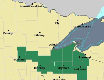
Possible heavy rainfall in the storms could lead to minor flooding from central Minnesota into northwest Wisconsin in areas that already got 1 to 3 inches of rain on Sunday into Sunday night.
The National Weather Service has issued a Flood Watch from late Tuesday into Wednesday for much of the area.
Excessive runoff could result in flooding around rivers, creeks, streams and other low lying flood prone locations.


Comments